Hurricane Ernesto Heads for UK: Heavy Rain, Strong Winds, and Coastal Warnings Issued
August 21, 2024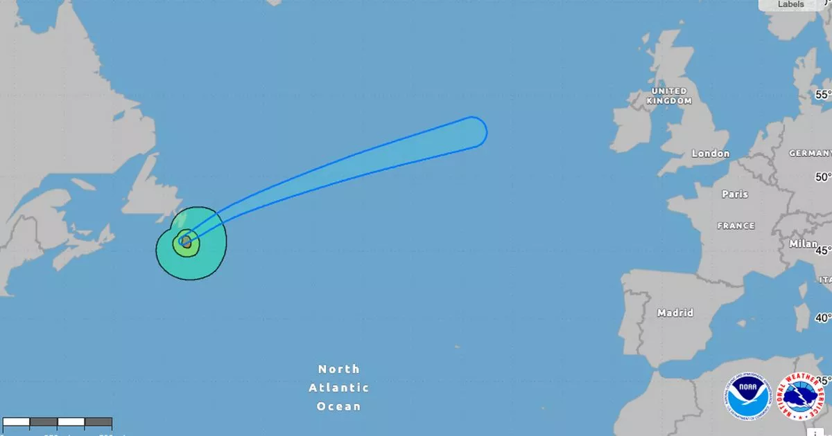
Hurricane Ernesto, now upgraded to a Category 1 hurricane, has already caused significant flooding in parts of the Caribbean.
The heavy rain is forecasted to move across regions including Cumbria, Lancashire, Wales, and the Midlands before arriving in the Southeast of England by Thursday morning.
The Met Office predicts that rain will begin moving in from the southwest on Wednesday morning, with the heaviest downpours expected over hilly areas.
The Met Office has issued warnings of heavy downpours and strong winds particularly affecting Central, Tayside & Fife, Highlands & Eilean Siar, southwest Scotland, Lothian Borders, and Strathclyde.
A yellow weather warning is currently in effect for large parts of northern Scotland from Wednesday at 9am until Thursday at 3pm due to the anticipated severe weather.
Along the coast, wind gusts may reach 50-60 mph, which could create dangerous coastal conditions, especially with the occurrence of spring tides.
Met Office Chief Meteorologist Jason Kelly has warned of hazardous coastal conditions resulting from the combination of heavy rain, strong winds, and spring tides.
Meteorologist Mike Chillit has indicated that NOAA data supports the hurricane's trajectory toward the UK, specifically noting its approach to Dublin.
As the remnants of Hurricane Ernesto reach the UK, they are expected to bring heavy rainfall of up to 100mm and winds reaching 60mph in the coming days.
In fact, many areas could see between 75-100mm of rain, with some locations potentially receiving as much as 150mm within a 24-hour period.
Summary based on 0 sources