AI-Powered Geospatial Tech Achieves 91.7% Accuracy in Predicting Wildfire Risks, Revolutionizes Utility Safety Measures
June 16, 2024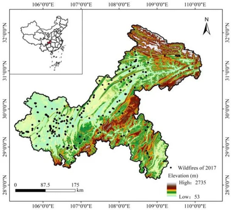
Todd Slind, VP of Technology at Locana, emphasizes the critical role of geospatial technology and AI/ML in tackling climate change challenges for utilities, especially in wildfire risk mitigation.
A new machine learning model developed in Chongqing Municipality, China, integrates historical data with topographical and meteorological factors to predict wildfire susceptibility.
The model employs a Continuous Convolutional Neural Network (CCNN) with a Channel Attention mechanism (CA) and has achieved an impressive 91.7% accuracy in predicting fire susceptibility.
This model's capability to capture spatial dependencies and produce detailed wildfire susceptibility maps highlights its effectiveness in improving risk assessment and management strategies for utilities.
By leveraging AI/ML and geospatial technology, utilities can automate and streamline wildfire risk assessment processes, leading to more focused and efficient resource deployment to safeguard public safety and infrastructure from wildfire impacts.
Summary based on 0 sources